


LLKZ - Kzeiot Airstrip
Located in Kzi'ot, Israel
ICAO - , IATA -
Data provided by AirmateGeneral information
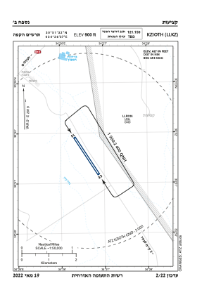
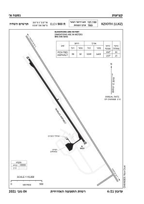
Coordinates: N30°51'32" E34°26'37"
Elevation is 846 feet MSL.
Magnetic variation is 5° East View others Airports in South District
Operational data
Special qualification required
Current time UTC:
Current local time:
Communications frequencies: [VIEW]
Runways:
| RWY identifier | QFU | Length (ft) | Width (ft) | Surface | LDA (ft) |
| 15 | 147° | 4926 | 98 | ASPH | |
| 33 | 327° | 4926 | 98 | ASPH |
Airport contact information
Address: Kzi'ot Israel