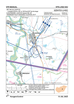
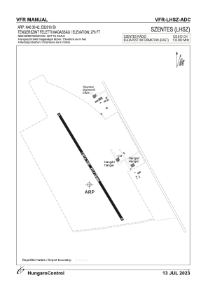


LHSZ - Szentes
Located in Szentes, Hungary
ICAO - LHSZ, IATA -
Data provided by AirmateGeneral information
Coordinates: N46°36'42" E20°16'59"
Elevation is 276 feet MSL.
Magnetic variation is 3.9° East View others Airports in Csongrád
Operational data
Special qualification required
Current time UTC:
Current local time:
Communications frequencies: [VIEW]
Runways:
| RWY identifier | QFU | Length (ft) | Width (ft) | Surface | LDA (ft) |
| 15 | 0° | 2461 | 492 | GRASS | |
| 33 | 0° | 2461 | 492 | GRASS |
Airport contact information
Address: Szentes Hungary