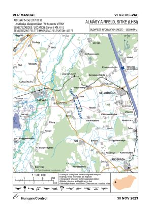
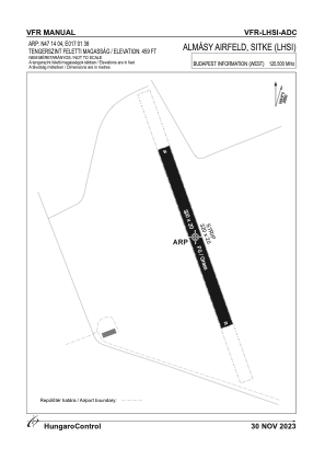


LHSI - Sitke
Located in Sitke, Hungary
ICAO - , IATA -
Data provided by AirmateGeneral information
Coordinates: N47°14'6" E17°1'35"
Elevation is 459 feet MSL.
View others Airports in Vas
Operational data
Special qualification required
Current time UTC:
Current local time:
Weather at : LHPA - Papa ( 38 km )
METAR: LHPA 240745Z 32011KT 280V340 4000 -RA BR BKN007 OVC023 06/04 Q1006 NOSIG RMK GRN
TAF: TAF LHPA 240515Z 2406/2506 33016G26KT 6000 -RA SCT015 BKN020 OVC060 TEMPO 2406/2412 3000 RA BR BKN005 OVC015 BECMG 2412/2415 9999 NSW BKN030 OVC083 BECMG 2415/2418 24004KT 6000 SCT030 BKN083 BECMG 2500/2503 VRB03KT 3000 BR NSC PROB40 TEMPO 2500/2506 0600 FG BKN003
Communications frequencies: [VIEW]
Runways:
| RWY identifier | QFU | Length (ft) | Width (ft) | Surface | LDA (ft) |
| 16 | 0° | 971 | 66 | GRASS | |
| 34 | 0° | 971 | 66 | GRASS |
Airport contact information
Address: Sitke Hungary