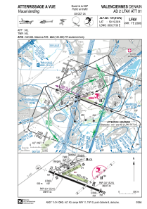
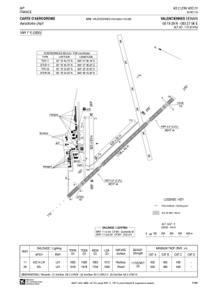


LFAV - Valenciennes Denain
Located in Valenciennes, France
ICAO - LFAV, IATA - XVS
Data provided by AirmateGeneral information
Coordinates: N50°19'29" E3°27'56"
Elevation is 165 feet MSL.
Magnetic variation is 1.29° East View others Airports in Nord-Pas-de-Calais
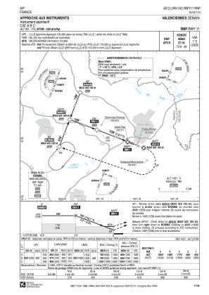
Operational data
Special qualification required
Current time UTC:
Current local time:
Communications frequencies: [VIEW]
Runways:
| RWY identifier | QFU | Length (ft) | Width (ft) | Surface | LDA (ft) |
| 11 | 111° | 5604 | 148 | ASPH | 4964 |
| 29 | 291° | 5604 | 148 | ASPH | 5223 |
| 06 | 61° | 2051 | 164 | GRASS | |
| 24 | 241° | 2051 | 164 | GRASS | |
| 11L | 111° | 2034 | 164 | GRASS | |
| 29R | 291° | 2034 | 164 | GRASS |
Airport contact information
Address: Valenciennes France


