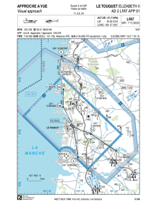
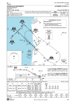
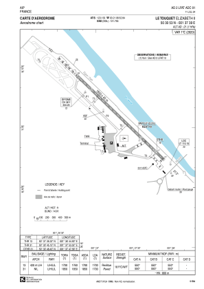


LFAT - Le Touquet Cote D'opale
Located in Le Touquet, France
ICAO - LFAT, IATA - LTQ
Data provided by AirmateGeneral information
Coordinates: N50°30'53" E1°37'39"
Elevation is 21 feet MSL.
Magnetic variation is 0.70° East View others Airports in Nord-Pas-de-Calais
Operational data
Special qualification required
Current time UTC:
Current local time:
Weather
METAR: LFAT 251300Z AUTO 24016KT 210V270 9999 FEW039 BKN045 BKN074 11/05 Q1004 NOSIG
TAF: TAF LFAT 251100Z 2512/2521 23013KT CAVOK TEMPO 2519/2521 4000 SHRA BKN020TCU BKN040
Communications frequencies: [VIEW]
Runways:
| RWY identifier | QFU | Length (ft) | Width (ft) | Surface | LDA (ft) |
| 13 | 133° | 6070 | 131 | ASPH | 5577 |
| 31 | 313° | 6070 | 131 | ASPH | 5577 |
Airport contact information
Address: Le Touquet France


