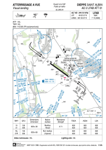


LFAB - Dieppe Saint Aubin
Located in Dieppe, France
ICAO - LFAB, IATA - DPE
Data provided by AirmateGeneral information
Coordinates: N49°52'57" E1°5'7"
Elevation is 344 feet MSL.
Magnetic variation is 0.57° East View others Airports in Upper Normandy
Operational data
Special qualification required
Current time UTC:
Current local time:
Communications frequencies: [VIEW]
Runways:
| RWY identifier | QFU | Length (ft) | Width (ft) | Surface | LDA (ft) |
| 13L | 126° | 2133 | 197 | GRASS | 2133 |
| 31R | 306° | 2133 | 197 | GRASS | 2133 |
| 13 | 126° | 2690 | 98 | ASPH | 2690 |
| 31 | 306° | 2690 | 98 | ASPH | 2690 |
Airport contact information
Address: Dieppe France
