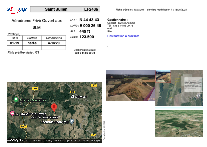


LF2436 - Saint Julien
Located in Saint-Julien-d'Eymet, France
ICAO - , IATA -
Data provided by AirmateGeneral information
Coordinates: N44°43'43" E0°26'46"
Elevation is 449 feet MSL.
View others Airports in Aquitaine
Operational data
Special qualification required
Current time UTC:
Current local time:
Weather at : LFBE - Bergerac Dordogne Perigord ( 12 km )
METAR: LFBE 190230Z AUTO 08003KT CAVOK 00/00 Q1025 TEMPO 3000 BR
TAF: TAF LFBE 182300Z 1900/1924 VRB03KT CAVOK PROB40 TEMPO 1904/1906 3000 BR BECMG 1912/1914 32005KT
Communications frequencies: [VIEW]
Runways:
| RWY identifier | QFU | Length (ft) | Width (ft) | Surface | LDA (ft) |
| 01 | 0° | 1541 | 65 | GRASS | |
| 19 | 0° | 1541 | 65 | GRASS |
Airport contact information
Address: Saint-Julien-d'Eymet France