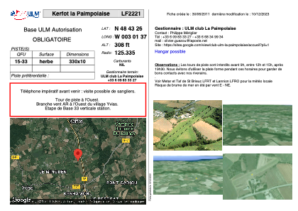


LF2221 - Kerfot la Paimpolaise
Located in Kerfot, France
ICAO - , IATA -
Data provided by AirmateGeneral information
Coordinates: N48°43'26" W3°1'37"
Elevation is 308 feet MSL.
View others Airports in Brittany
Operational data
Special qualification required
Current time UTC:
Current local time:
Weather at : LFRT - Saint Brieuc Armor ( 24 km )
METAR: LFRT 231300Z AUTO 02010KT 330V060 9999 BKN021 BKN028 BKN035 11/06 Q1023
Communications frequencies: [VIEW]
Runways:
| RWY identifier | QFU | Length (ft) | Width (ft) | Surface | LDA (ft) |
| 15 | 0° | 1082 | 32 | GRASS | |
| 33 | 0° | 1082 | 32 | GRASS |
Airport contact information
Address: Kerfot France