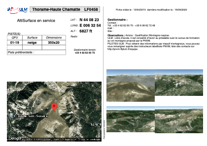


LF0458 - Thorame-Haute Chamatte
Located in Thorame-Haute, France
ICAO - , IATA -
Data provided by AirmateGeneral information
Coordinates: N44°8'23" E6°32'54"
Elevation is 6827 feet MSL.
View others Airports in Provence-Alpes-Côte-d'Azur
Operational data
Special qualification required
Current time UTC:
Current local time:
Communications frequencies: [VIEW]
Runways:
| RWY identifier | QFU | Length (ft) | Width (ft) | Surface | LDA (ft) |
| 01 | 0° | 1148 | 65 | SNOW | |
| 19 | 0° | 1148 | 65 | SNOW |
Airport contact information
Address: Thorame-Haute France