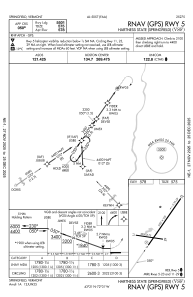


KVSF - Hartness State (Springfield)
Located in Springfield, United States
ICAO - VSF, IATA - VSF
Data provided by AirmateGeneral information
Coordinates: N43°20'37" W72°31'2"
Elevation is 577 feet MSL.
Magnetic variation is -15° East View others Airports in Vermont
Operational data
Special qualification required
Current time UTC:
Current local time:
Weather
METAR: KVSF 162254Z AUTO VRB06KT 10SM CLR 17/M02 A3008 RMK AO2 SLP189 T01671017
Communications frequencies: [VIEW]
Runways:
| RWY identifier | QFU | Length (ft) | Width (ft) | Surface | LDA (ft) |
| 05 | 35° | 5501 | 100 | ASPH | |
| 23 | 215° | 5501 | 100 | ASPH | |
| 11 | 99° | 3000 | 75 | ASPH | |
| 29 | 279° | 3000 | 75 | ASPH |
Airport contact information
Address: Springfield United States
