


KTVI - Thomasville Rgnl
Located in Thomasville, United States
ICAO - TVI, IATA -
Data provided by AirmateGeneral information
Coordinates: N30°54'5" W83°52'53"
Elevation is 263 feet MSL.
Magnetic variation is -05° East View others Airports in Georgia
Operational data
Special qualification required
Current time UTC:
Current local time:
Weather
METAR: KTVI 191735Z AUTO 32004KT 10SM SCT022 26/18 A3008 RMK AO2
Communications frequencies: [VIEW]
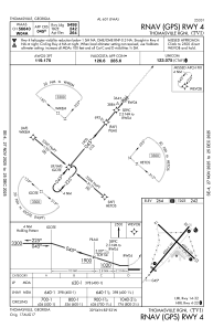
Runways:
| RWY identifier | QFU | Length (ft) | Width (ft) | Surface | LDA (ft) |
| 04 | 40° | 6004 | 101 | ASPH | 5498 |
| 22 | 220° | 6004 | 101 | ASPH | 5504 |
| 14 | 133° | 4999 | 100 | ASPH | |
| 32 | 313° | 4999 | 100 | ASPH |
Airport contact information
Address: Thomasville United States