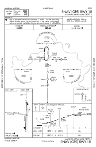


KMHL - Marshall Meml Muni
Located in Marshall, United States
ICAO - MHL, IATA - MHL
Data provided by AirmateGeneral information
Coordinates: N39°5'44" W93°12'11"
Elevation is 778 feet MSL.
Magnetic variation is 03° East View others Airports in Missouri
Operational data
Special qualification required
Current time UTC:
Current local time:
Communications frequencies: [VIEW]
Runways:
| RWY identifier | QFU | Length (ft) | Width (ft) | Surface | LDA (ft) |
| 09 | 96° | 3303 | 150 | GRASS | |
| 27 | 276° | 3303 | 150 | GRASS | |
| 18 | 181° | 5005 | 75 | CONC | |
| 36 | 1° | 5005 | 75 | CONC |
Airport contact information
Address: Marshall United States