


KIAD - Washington Dulles Intl
Located in Washington, United States
ICAO - IAD, IATA - IAD
Data provided by AirmateGeneral information
Coordinates: N38°56'51" W77°27'36"
Elevation is 312 feet MSL.
Magnetic variation is -10° East View others Airports in District of Columbia
Operational data
Special qualification required
Current time UTC:
Current local time:
Weather
METAR: KIAD 200752Z 27003KT 10SM OVC010 13/11 A3000 RMK AO2 RAB19E30 SLP159 P0000 T01280111
TAF: KIAD 200539Z 2006/2112 VRB03KT P6SM -SHRA SCT008 OVC015 FM200900 32004KT P6SM OVC025 FM201300 32007KT P6SM OVC050 FM201600 30015G25KT P6SM FEW090 FM210200 34009KT P6SM FEW250 FM210600 33004KT P6SM FEW150 SCT200
Communications frequencies: [VIEW]
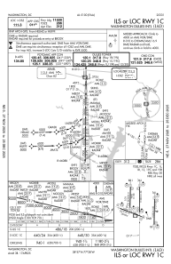
Runways:
| RWY identifier | QFU | Length (ft) | Width (ft) | Surface | LDA (ft) |
| 01R | 1° | 11500 | 150 | CONC | 11500 |
| 19L | 181° | 11500 | 150 | CONC | 11500 |
| 01L | 1° | 9400 | 150 | CONC | 9400 |
| 19R | 181° | 9400 | 150 | CONC | 9400 |
| 12 | 111° | 10501 | 150 | CONC | 10501 |
| 30 | 291° | 10501 | 150 | CONC | 10501 |
| 01C | 1° | 11500 | 150 | CONC | 11500 |
| 19C | 181° | 11500 | 150 | CONC | 11089 |
Airport contact information
Address: Washington United States