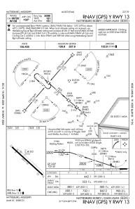


KHBG - Hattiesburg Bobby L Chain Muni
Located in Hattiesburg, United States
ICAO - HBG, IATA -
Data provided by AirmateGeneral information
Coordinates: N31°15'54" W89°15'10"
Elevation is 150 feet MSL.
Magnetic variation is -01° East View others Airports in Mississippi
Operational data
Special qualification required
Current time UTC:
Current local time:
Weather
METAR: KHBG 252253Z AUTO VRB05KT 10SM CLR 28/16 A3003 RMK AO2 SLP167 T02830161
TAF: KHBG 252320Z 2600/2624 17005KT P6SM FEW070 FM261100 14003KT 3SM BR FEW012 FM261330 16014G23KT P6SM SCT050
Communications frequencies: [VIEW]
Runways:
| RWY identifier | QFU | Length (ft) | Width (ft) | Surface | LDA (ft) |
| 13 | 131° | 6094 | 150 | ASPH | |
| 31 | 311° | 6094 | 150 | ASPH |
Airport contact information
Address: Hattiesburg United States
