


KCEY - Kyle-Oakley Fld
Located in Murray, United States
ICAO - CEY, IATA - CEY
Data provided by AirmateGeneral information
Coordinates: N36°39'52" W88°22'22"
Elevation is 577 feet MSL.
Magnetic variation is -02° East View others Airports in Kentucky
Operational data
Special qualification required
Current time UTC:
Current local time:
Weather
METAR: KCEY 201615Z AUTO 01015G21KT 10SM CLR 15/M02 A3029 RMK A01
Communications frequencies: [VIEW]
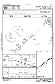
Runways:
| RWY identifier | QFU | Length (ft) | Width (ft) | Surface | LDA (ft) |
| 05 | 50° | 6202 | 100 | ASPH | |
| 23 | 230° | 6202 | 100 | ASPH |
Airport contact information
Address: Murray United States
