

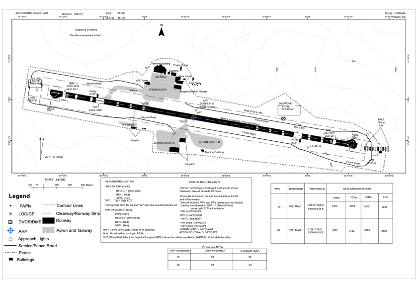


HRYR - Kigali International
Located in Kigali, Rwanda
ICAO - HRYR, IATA - KGL
Data provided by AirmateGeneral information
Coordinates: S1°58'6" E30°8'18"
Elevation is 4883 feet MSL.
View others Airports in Ville de Kigali
Operational data
Special qualification required
Current time UTC:
Current local time:
Communications frequencies: [VIEW]
Runways:
| RWY identifier | QFU | Length (ft) | Width (ft) | Surface | LDA (ft) |
| 10 | 100° | 11483 | 148 | ASP | |
| 28 | 280° | 11483 | 148 | ASP |
Airport contact information
Address: Kigali Rwanda