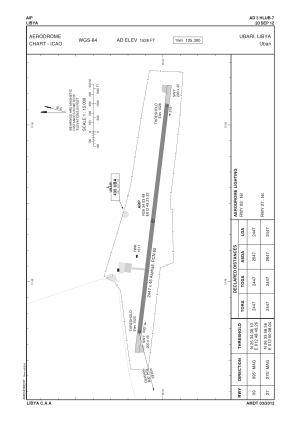


HLUB - Ubari
Located in Ubari, Libyan Arab Jamahiriya
ICAO - , IATA - QUB
Data provided by AirmateGeneral information
Coordinates: N26°34'3" E12°49'23"
Elevation is 1528 feet MSL.
Magnetic variation is 3° East View others Airports in Wadi Al Shatii District
Operational data
Special qualification required
Current time UTC:
Current local time:
Weather at : - ( 0 km )
METAR: KSOP 200852Z AUTO 00000KT 1 1/4SM BR OVC003 18/18 A2996 RMK AO2
Communications frequencies: [VIEW]
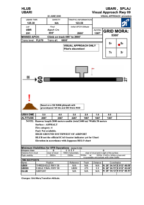
Runways:
| RWY identifier | QFU | Length (ft) | Width (ft) | Surface | LDA (ft) |
| 09 | 97° | 8363 | 94 | ASPH | |
| 27 | 277° | 8363 | 94 | ASPH |
Airport contact information
Address: Ubari Libyan Arab Jamahiriya