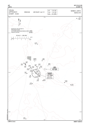
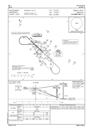
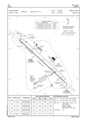


HLLS - Sebha/International
Located in Sebha, Libyan Arab Jamahiriya
ICAO - HLLS, IATA - SEB
Data provided by AirmateGeneral information
Coordinates: N26°59'13" E14°28'21"
Elevation is 1427 feet MSL.
Magnetic variation is 3° East View others Airports in Sabha District
Operational data
Special qualification required
Current time UTC:
Current local time:
Weather at : - ( 0 km )
METAR: K2V6 251519Z AUTO 12006KT 10SM BKN010 15/06 A2981 RMK AO2
Communications frequencies: [VIEW]
Runways:
| RWY identifier | QFU | Length (ft) | Width (ft) | Surface | LDA (ft) |
| 06 | 61° | 4447 | 95 | ASPH | |
| 24 | 241° | 4447 | 95 | ASPH | |
| 13R | 133° | 11782 | 136 | ASPH CONC | |
| 31L | 313° | 11782 | 136 | ASPH CONC | |
| 31R | 313° | 8148 | 97 | ASPH CONC | |
| 13L | 133° | 8148 | 97 | ASPH CONC |
Airport contact information
Address: Sebha Libyan Arab Jamahiriya