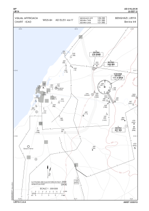
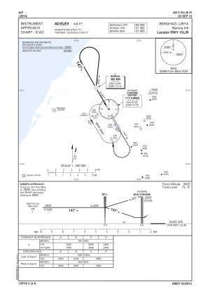
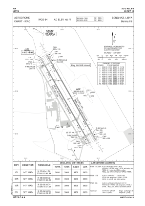


HLLB - Benghazi/ Benina International
Located in Benghazi, Libyan Arab Jamahiriya
ICAO - HLLB, IATA - BEN
Data provided by AirmateGeneral information
Coordinates: N32°5'48" E20°16'10"
Elevation is 436 feet MSL.
Magnetic variation is 4° East View others Airports in Benghazi District
Operational data
Special qualification required
Current time UTC:
Current local time:
Weather
TAF: TAF HLLB 191700Z 1918/2018 33012G22KT 7000 SCT025 SCT060
Communications frequencies: [VIEW]
Runways:
| RWY identifier | QFU | Length (ft) | Width (ft) | Surface | LDA (ft) |
| 15R | 150° | 11811 | 148 | ASP | |
| 33L | 330° | 11811 | 148 | ASPH | |
| 15L | 150° | 11811 | 148 | ASPH | |
| 33R | 330° | 11811 | 148 | ASPH |
Airport contact information
Address: Benghazi Libyan Arab Jamahiriya