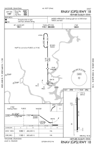


H68 - Hefner-Easley
Located in Wagoner, United States
ICAO - H68, IATA -
Data provided by AirmateGeneral information
Coordinates: N35°57'56" W95°20'31"
Elevation is 599 feet MSL.
Magnetic variation is 04° East View others Airports in Oklahoma
Operational data
Special qualification required
Current time UTC:
Current local time:
Weather at : KTQH - Tahlequah Muni ( 31 km )
METAR: KTQH 161555Z AUTO 19016G21KT 10SM BKN019 BKN024 OVC031 21/17 A2976 RMK AO2
Communications frequencies: [VIEW]
Runways:
| RWY identifier | QFU | Length (ft) | Width (ft) | Surface | LDA (ft) |
| 18 | 180° | 3401 | 60 | ASPH | |
| 36 | 360° | 3401 | 60 | ASPH |
Airport contact information
Address: Wagoner United States