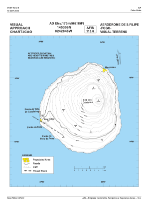
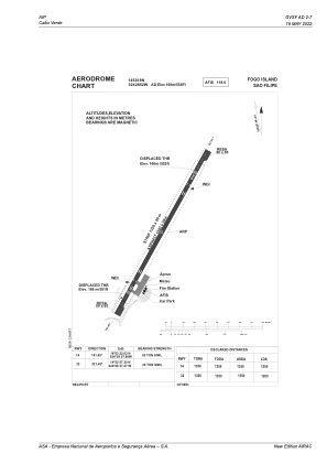


GVSF - Fogo Island/Sao Filipe
Located in Sao Filipe, Cape Verde
ICAO - GVSF, IATA - SFL
Data provided by AirmateGeneral information
Coordinates: N14°53'9" W24°28'52"
Elevation is 556 feet MSL.
View others Airports in Sotavento Islands
Operational data
Special qualification required
Current time UTC:
Current local time:
Weather at : - ( 0 km )
METAR: RCFN 250635Z 20006KT 180V240 3500 SHRA FEW010 BKN016 BKN040 24/23 Q1009 NOSIG RMK A2982
Communications frequencies: [VIEW]
Runways:
| RWY identifier | QFU | Length (ft) | Width (ft) | Surface | LDA (ft) |
| 14 | 130° | 4921 | 98 | UNK | |
| 32 | 310° | 4921 | 98 | UNK |
Airport contact information
Address: Sao Filipe Cape Verde