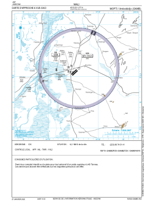
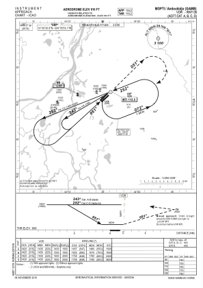


GAMB - Mopti/Ambodedjo
Located in Mopti, Mali
ICAO - GAMB, IATA - MZI
Data provided by AirmateGeneral information
Coordinates: N14°30'31" W4°5'3"
Elevation is 910 feet MSL.
View others Airports in Mopti
Operational data
Special qualification required
Current time UTC:
Current local time:
Weather
METAR: GAMB 160700Z 02010KT 6000 NSC 25/01 Q1013
Communications frequencies: [VIEW]
Runways:
| RWY identifier | QFU | Length (ft) | Width (ft) | Surface | LDA (ft) |
| 05 | 47° | 8333 | 98 | ASP | |
| 23 | 227° | 8333 | 98 | ASP |
Airport contact information
Address: Mopti Mali