


GAKD - Kayes Dag-Dag
Located in Kayes, Mali
ICAO - , IATA - KYS
Data provided by AirmateGeneral information
Coordinates: N14°28'54" W11°24'7"
Elevation is 164 feet MSL.
View others Airports in Kayes
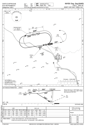
Operational data
Special qualification required
Current time UTC:
Current local time:
Weather
METAR: GAKD 241600Z VRB04KT 8000 NSC 46/17 Q1006
Communications frequencies: [VIEW]
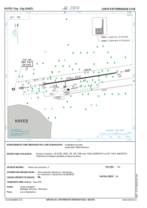
Runways:
| RWY identifier | QFU | Length (ft) | Width (ft) | Surface | LDA (ft) |
| 09 | 81° | 8858 | 148 | UNK | |
| 27 | 261° | 8858 | 148 | UNK |
Airport contact information
Address: Kayes Mali