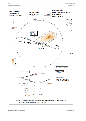
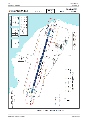


FIMR - Plaine Corail Airport (National)
Located in Port Mathurin, Mauritius
ICAO - FIMR, IATA - RRG
Data provided by AirmateGeneral information
Coordinates: S19°45'28" E63°21'41"
Elevation is 93 feet MSL.
View others Airports in Rodrigues Island
Operational data
Special qualification required
Current time UTC:
Current local time:
Weather
TAF: TAF FIMR 251750Z 2518/2612 10012KT 9999 SCT017
Communications frequencies: [VIEW]
Runways:
| RWY identifier | QFU | Length (ft) | Width (ft) | Surface | LDA (ft) |
| 12 | 106° | 4222 | 98 | ASP | |
| 30 | 286° | 4222 | 98 | ASP |
Airport contact information
Address: Port Mathurin Mauritius