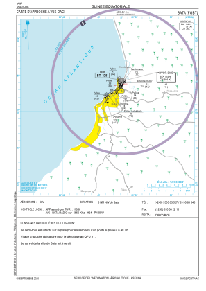
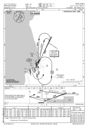
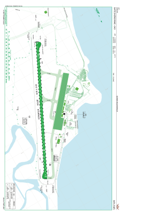


FGBT - Bata
Located in Bata, Equatorial Guinea
ICAO - FGBT, IATA - BSG
Data provided by AirmateGeneral information
Coordinates: N1°54'8" E9°48'10"
Elevation is 16 feet MSL.
View others Airports in Litoral
Operational data
Special qualification required
Current time UTC:
Current local time:
Weather
TAF: FGBT 251100Z 2512/2612 19006KT 9999 SCT010 TEMPO 2514/2520 3000 TSRA BKN010 FEW020CB PROB40 TEMPO 2602/2607 4000 TSRA BKN008 FEW018CB
Communications frequencies: [VIEW]
Runways:
| RWY identifier | QFU | Length (ft) | Width (ft) | Surface | LDA (ft) |
| 03 | 27° | 10860 | 197 | UNK | |
| 21 | 207° | 10860 | 197 | UNK |
Airport contact information
Address: Bata Equatorial Guinea