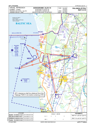
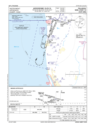
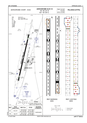


EYPA - Palanga/International
Located in Palanga, Lithuania
ICAO - EYPA, IATA - PLQ
Data provided by AirmateGeneral information
Coordinates: N55°58'23" E21°5'38"
Elevation is 33 feet MSL.
Magnetic variation is 6° East View others Airports in Klaipeda County
Operational data
Special qualification required
Current time UTC:
Current local time:
Weather
METAR: EYPA 241020Z 08006KT 040V160 9999 FEW048 09/M03 Q1011
TAF: TAF EYPA 240502Z 2406/2506 12010KT 9000 NSC BECMG 2412/2414 SCT010 OVC020 BECMG 2415/2416 04010KT 5000 RA BKN005 OVC015 TEMPO 2418/2503 1500 DZ OVC002 BECMG 2505/2507 34010KT 8000 NSW OVC005
Communications frequencies: [VIEW]
Runways:
| RWY identifier | QFU | Length (ft) | Width (ft) | Surface | LDA (ft) |
| 01 | 13° | 7480 | 148 | CONC+ASPH | 6988 |
| 19 | 193° | 7480 | 148 | CONC+ASPH | 6988 |
Airport contact information
Address: Palanga Lithuania