
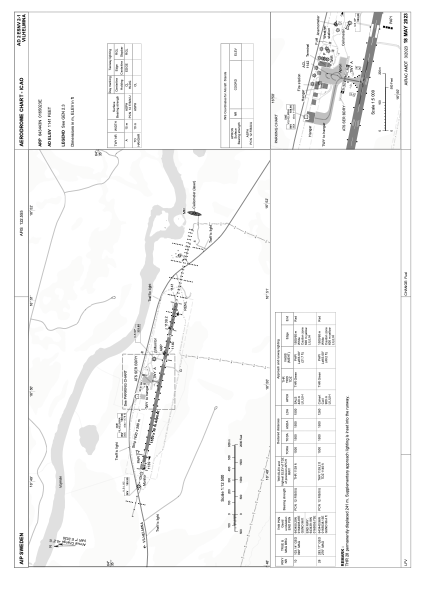


ESNV - Vilhelmina
Located in Vilhelmina, Sweden
ICAO - ESNV, IATA - VHM
Data provided by AirmateGeneral information
Coordinates: N64°34'43" E16°50'23"
Elevation is 1141 feet MSL.
Magnetic variation is +7.0° East View others Airports in Västerbottens län
Operational data
Special qualification required
Current time UTC:
Current local time:
Weather
METAR: ESNV 200820Z AUTO 36009KT 320V030 9999 NCD M03/M13 Q1014
Communications frequencies: [VIEW]
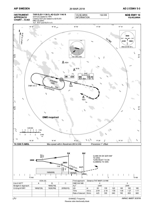
Runways:
| RWY identifier | QFU | Length (ft) | Width (ft) | Surface | LDA (ft) |
| 10 | 103° | 4921 | 98 | ASPH | 4921 |
| 28 | 283° | 4921 | 98 | ASPH | 4134 |
Airport contact information
Address: Vilhelmina Sweden