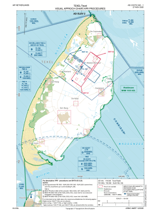
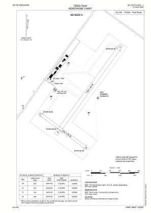


EHTX - Texel/Texel
Located in Den Burg, Netherlands
ICAO - EHTX, IATA -
Data provided by AirmateGeneral information
Coordinates: N53°6'55" E4°50'1"
Elevation is 2 feet MSL.
Magnetic variation is 1.4960° East View others Airports in Noord-Holland
Operational data
Special qualification required
Current time UTC:
Current local time:
Communications frequencies: [VIEW]
Runways:
| RWY identifier | QFU | Length (ft) | Width (ft) | Surface | LDA (ft) |
| 03 | 36° | 3638 | 131 | GRASS | |
| 21 | 216° | 3638 | 131 | GRASS | |
| 12 | 126° | 2041 | 131 | GRASS | |
| 30 | 306° | 2041 | 131 | GRASS |
Airport contact information
Address: Den Burg Netherlands