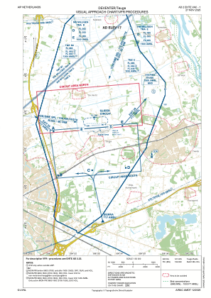
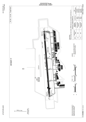


EHTE - Deventer/Teuge
Located in Deventer, Netherlands
ICAO - EHTE, IATA -
Data provided by AirmateGeneral information
Coordinates: N52°14'41" E6°2'48"
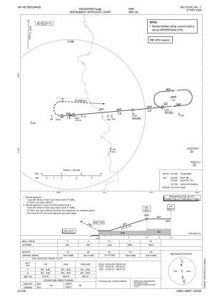
Elevation is 17 feet MSL.
Magnetic variation is 1.9239° East View others Airports in Gelderland
Operational data
Special qualification required
Current time UTC:
Current local time:
Weather at : EHDL - Deelen ( 24 km )
METAR: EHDL 192025Z AUTO 31009KT 240V010 9999 RA FEW011 FEW015CB SCT017 BKN020 06/04 Q1013 WHT
Communications frequencies: [VIEW]
Runways:
| RWY identifier | QFU | Length (ft) | Width (ft) | Surface | LDA (ft) |
| 08 | 85° | 3934 | 89 | CONC+ASPH | |
| 26 | 265° | 3934 | 89 | CONC+ASPH |
Airport contact information
Address: Deventer Netherlands

