


EHOW - Oostwold/Oostwold
Located in Oostwold, Netherlands
ICAO - EHOW, IATA - ---
Data provided by AirmateGeneral information
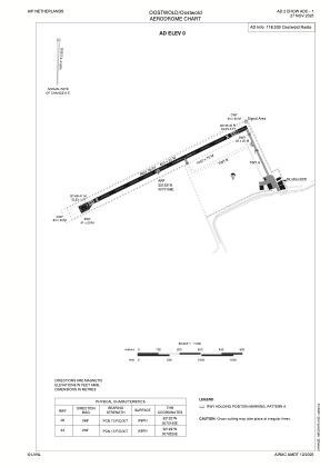
Coordinates: N53°12'31" E7°1'58"
Elevation is 3 feet MSL.
Magnetic variation is 2.2242° East View others Airports in Groningen
Operational data
Special qualification required
Current time UTC:
Current local time:
Communications frequencies: [VIEW]
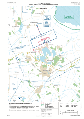
Runways:
| RWY identifier | QFU | Length (ft) | Width (ft) | Surface | LDA (ft) |
| 06 | 67° | 2625 | 66 | CONC+ASPH | |
| 24 | 247° | 2625 | 66 | CONC+ASPH |
Airport contact information
Address: Oostwold Netherlands