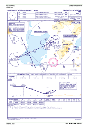
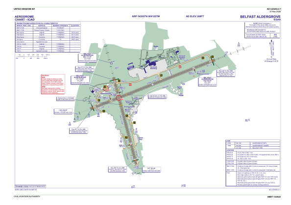


EGAA - Belfast Aldergrove
Located in Belfast, United Kingdom
ICAO - EGAA, IATA - BFS
Data provided by AirmateGeneral information
Coordinates: N54°39'27" W6°12'57"
Elevation is 268 feet MSL.
View others Airports in Northern Ireland
Operational data
Special qualification required
Current time UTC:
Current local time:
Weather
METAR: EGAA 200820Z AUTO 32004KT 270V350 9999 NCD 07/06 Q1030
TAF: TAF EGAA 200456Z 2006/2106 VRB03KT 9999 FEW030 PROB30 TEMPO 2006/2007 5000 BR MIFG PROB30 2102/2106 5000 BR
Communications frequencies: [VIEW]
Runways:
| RWY identifier | QFU | Length (ft) | Width (ft) | Surface | LDA (ft) |
| 17 | 162° | 6204 | 148 | ASP | |
| 35 | 342° | 6204 | 148 | ASP | |
| 07 | 65° | 9121 | 148 | ASP | |
| 25 | 245° | 9121 | 148 | ASP |
Airport contact information
Address: Belfast United Kingdom

