


EEKE - Kuressaare
Located in Kuressaare, Estonia
ICAO - EEKE, IATA - URE
Data provided by AirmateGeneral information
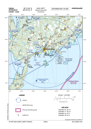
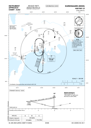
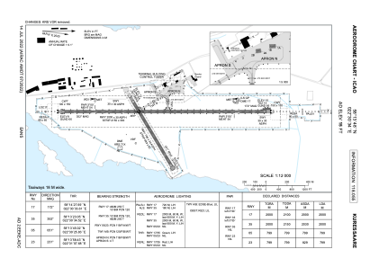
Coordinates: N58°13'48" E22°30'34"
Elevation is 15 feet MSL.
Magnetic variation is 8° East View others Airports in Saare County
Operational data
Special qualification required
Current time UTC:
Current local time:
Weather
METAR: EEKE 250520Z 03010KT 9000 -RA SCT007 OVC024 03/03 Q1002
TAF: TAF COR EEKE 250455Z 2504/2510 04010KT 9999 BKN007 OVC015 TEMPO 2504/2510 2000 RA BR BKN004 OVC010
Communications frequencies: [VIEW]
Runways:
| RWY identifier | QFU | Length (ft) | Width (ft) | Surface | LDA (ft) |
| 17 | 180° | 6562 | 98 | ASPH | 6562 |
| 35 | 360° | 6562 | 98 | ASPH | 6562 |
| 05 | 59° | 2621 | 98 | ASPH | 2621 |
| 23 | 239° | 2621 | 98 | ASPH | 2621 |
Airport contact information
Address: Kuressaare Estonia