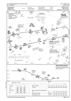
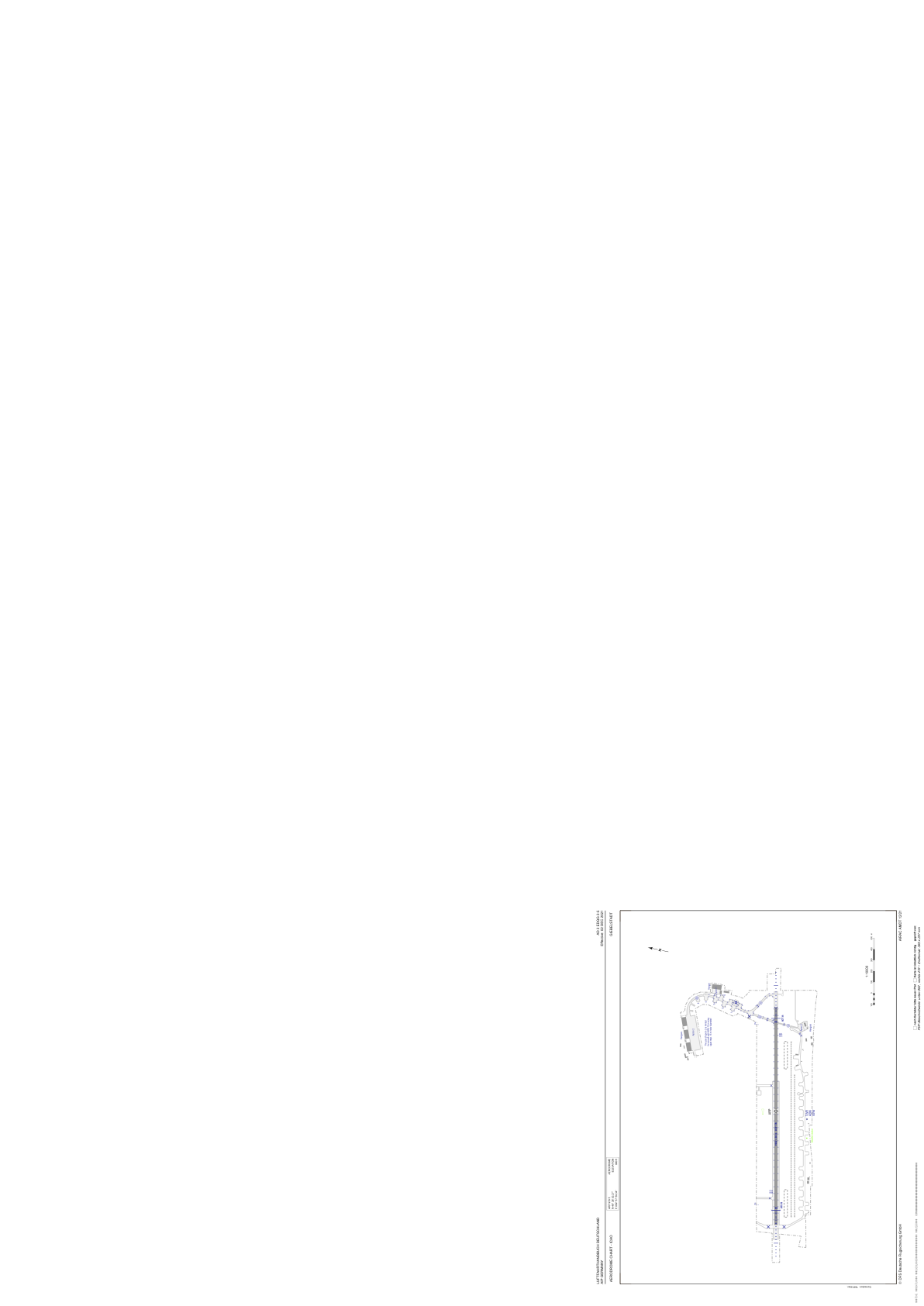


EDQG - Giebelstadt
Located in Giebelstadt, Germany
ICAO - EDQG, IATA - GHF
Data provided by AirmateGeneral information
Coordinates: N49°38'53" E9°57'59"
Elevation is 980 feet MSL.
Magnetic variation is 2.8000° East View others Airports in Bavaria
Operational data
Special qualification required
Current time UTC:
Current local time:
Weather at : ETHN - Niederstetten ( 28 km )
METAR: ETHN 192020Z 28014KT 9999 FEW006 BKN015 04/03 Q1008 WHT
Communications frequencies: [VIEW]
Runways:
| RWY identifier | QFU | Length (ft) | Width (ft) | Surface | LDA (ft) |
| 08 | 78° | 6503 | 98 | CONC | 6060 |
| 26 | 258° | 6503 | 98 | CONC | 6175 |
Airport contact information
Address: Giebelstadt Germany
