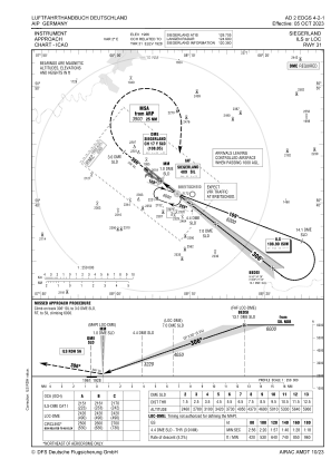
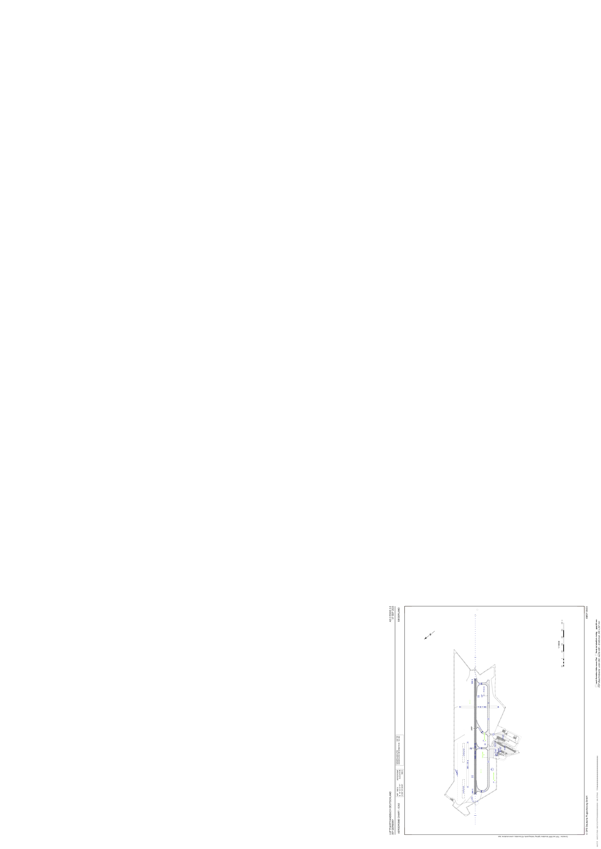


EDGS - Siegerland
Located in Siegen, Germany
ICAO - EDGS, IATA - SGE
Data provided by AirmateGeneral information
Coordinates: N50°42'28" E8°4'59"
Elevation is 1966 feet MSL.
Magnetic variation is 2.3000° East View others Airports in North Rhine-Westphalia
Operational data
Special qualification required
Current time UTC:
Current local time:
Communications frequencies: [VIEW]
Runways:
| RWY identifier | QFU | Length (ft) | Width (ft) | Surface | LDA (ft) |
| 04 | 40° | 1640 | 98 | GRASS | 1640 |
| 22 | 220° | 1640 | 98 | GRASS | 1640 |
| 13 | 128° | 5315 | 98 | ASPH | 5315 |
| 31 | 308° | 5315 | 98 | ASPH | 5315 |
| 13G | 128° | 1969 | 98 | GRASS | 1969 |
| 31G | 308° | 1969 | 98 | GRASS | 1969 |
| 13L | 128° | 1969 | 98 | GRS | |
| 31R | 308° | 1969 | 98 | GRS |
Airport contact information
Address: Siegen Germany
