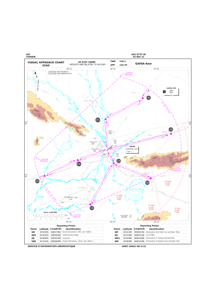
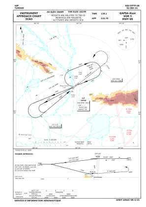
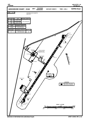


DTTF - Gafsa/Ksar
Located in Gafsa, Tunisia
ICAO - DTTF, IATA - GAF
Data provided by AirmateGeneral information
Coordinates: N34°24'56" E8°48'49"
Elevation is 1060 feet MSL.
View others Airports in Gafsa Governorate
Operational data
Special qualification required
Current time UTC:
Current local time:
Weather
METAR: DTTF 240000Z 02009KT 9999 SCT033 15/10 Q1012
TAF: TAF DTTF 232100Z 2322/2407 06010KT 9999 SCT026 BECMG 2322/2324 04020KT TEMPO 2400/2403 03020G32KT
Communications frequencies: [VIEW]
Runways:
| RWY identifier | QFU | Length (ft) | Width (ft) | Surface | LDA (ft) |
| 05 | 49° | 9514 | 148 | ASP | |
| 23 | 229° | 9514 | 148 | ASP |
Airport contact information
Address: Gafsa Tunisia