


CZUM - Churchill Falls
Located in Churchill Falls, Canada
ICAO - CZUM, IATA - ZUM
Data provided by AirmateGeneral information
Coordinates: N53°33'45" W64°6'21"
Elevation is 1437 feet MSL.
Magnetic variation is -19.8995° East View others Airports in Newfoundland and Labrador
Operational data
Special qualification required
Current time UTC:
Current local time:
Weather
METAR: CZUM 240536Z AUTO 34008KT 2SM -SN FEW017 BKN022 OVC042 M05/M07 A2971 RMK VIS VRB 1-3 SLP091
TAF: TAF AMD CZUM 240416Z 2404/2414 29008KT 6SM -SN SCT007 OVC025 TEMPO 2404/2406 1 1/2SM -SN BKN007 OVC025 FM240600 35012KT 1 1/2SM -SN BKN007 OVC025 TEMPO 2406/2408 6SM -SN SCT007 OVC025 PROB30 2406/2408 3/4SM -SN FM240800 34010KT 3/4SM -SN VV007 TEMPO 2408/2413 3SM -SN OVC015 FM241300 36012KT 3SM -SN OVC025 RMK FCST BASED ON AUTO OBS. NXT FCST BY 240800Z
Communications frequencies: [VIEW]
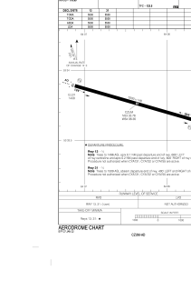
Runways:
| RWY identifier | QFU | Length (ft) | Width (ft) | Surface | LDA (ft) |
| 13 | 105° | 5500 | 148 | ASPH | 5500 |
| 31 | 285° | 5500 | 148 | ASPH | 5500 |
Airport contact information
Address: Churchill Falls Canada