


CYCG - West Kootenay Regional
Located in Castlegar, Canada
ICAO - CYCG, IATA - YCG
Data provided by AirmateGeneral information
Coordinates: N49°17'46" W117°37'57"
Elevation is 1626 feet MSL.
Magnetic variation is 15.3333° East View others Airports in British Columbia
Operational data
Special qualification required
Current time UTC:
Current local time:
Weather
METAR: CYCG 250100Z 16007KT 15SM BKN082 OVC100 17/M01 A2983 RMK AC6AC2 SLP111 DENSITY ALT 2300FT
TAF: TAF CYCG 250040Z 2501/2504 19008KT P6SM BKN080 RMK NXT FCST BY 251500Z
Communications frequencies: [VIEW]
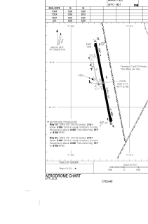
Runways:
| RWY identifier | QFU | Length (ft) | Width (ft) | Surface | LDA (ft) |
| 15 | 169° | 5299 | 150 | ASPH | 5299 |
| 33 | 349° | 5299 | 150 | ASPH | 5299 |
Airport contact information
Address: Castlegar Canada